
Pueblo Blanco
Galisteo Basin Sites
- Lamy Jct
- Lower Arroyo Hondo Pueblo
- El Camino Real
- Chamisa Locita
- El Crestón
- Espinoso Ridge Pueblo
- La Cienega Pueblo (LA 3)
- La Cienega Pithouse Village
- La Cieneguilla Pueblo (LA 16)
- La Cieneguilla Petroglyphs
- Manzanares Pueblo
- Paa-ko
- Petroglyph Hill
- Pueblo Blanco
- Pueblo Colorado
- Pueblo Galisteo
- Pueblo Largo
- Pueblo San Cristóbal
- Pueblo San Lazaro
- Pueblo Shé
- Rote Chert Quarry
- San José de Las Huertas
- Upper Arroyo Hondo Pueblo
- Pueblo San Marcos
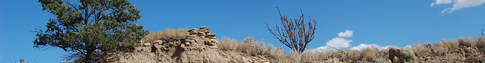
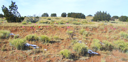
Pueblo Blanco is a large Pueblo IV–period Ancestral Pueblo village on the west side of the Galisteo Basin near Cerro Pelón.
The first
thorough documentation of the site was performed by N. C. Nelson in 1912.
According to Nelson, the ruins consist of at least 15–16 separate buildings
ranging from 6 rooms to large complexes of rooms. Individual roomblocks are
often conjoined at right angles, producing at least 6 fully enclosed and 6
partially open courts or plazas. Nelson estimated that the ruins retain at least 1,450 ground-floor rooms. Furthermore, he suggested that if 50 percent of the rooms had upper-story quarters, the total room count at Pueblo Blanco may have been more than 2,000 during its peak occupation. Several kivas and four refuse heaps can be identified within the ruins. In addition to mapping, testing, and researching at major ruins in the Galisteo Basin, Nelson excavated at least one masonry room in each Pueblo Blanco roomblock. Confusingly, Pueblo Blanco was referred to as Pueblo Largo by Bandelier and others. Nelson (1914: 91) depicts a group of artifacts from an altar in “Room3, of Building X, Pueblo Largo” which is actually Pueblo Blanco.
At least three manmade water reservoirs are believed to have been used during the occupation of Pueblo Blanco. One of them, the North Reservoir, is over 250 m north of the ruins. It was made by piling up earth in a restricted space between two rocky ridges to obstruct the water flow of a major drainage in the area. The earth needed for the embankment was excavated upslope from the dam, which is about 55 m long, 4–6 m wide, and up to 3.5 m high. The dam is breached in the center, and the cut is recorded on Nelson’s 1914 map. Two other water reservoirs were documented by Turney, both of which are south of the Crestón, a pronounced east-west-running volcanic dike. The Western Reservoir is over 0.5 km west southwest of the ruins, while the South Reservoir is more than 300 m south southwest of the ruins. Both of these features are on private land.
Two major geologic formations abut the limits of the pueblo. Less than 100 m north of the ruins is a flat outcrop of Mesa Verde Group sandstone. The southern limits of the site abut the east-west running volcanic hogback (Crestón). The sedimentary sandstone formation and the volcanic-capped hogback provided a wide range of usable lithic materials. Sedimentary materials include chert, limestone, siltstone, and claystone, while the volcanic materials that cap the Crestón contain outcrops of rhyolite, tuff, basalt, and andesite.
Diagnostic Rio Grande glaze wares indicate the main period of occupation falls in the Glaze A–C period (AD 1300–1490), although occasional Glaze D rim sherds have also been documented. More recent visits to the site indicated a sporadic presence of Glaze E rim sherds, primarily in the southwestern corner of the site north of Cañada del Medio, the large arroyo that cuts through the roomblocks.
Pueblo Blanco is number 801 on the State Register of Historic Places. It is located on New Mexico State Land Office land, private properties, and the Archaeological Conservancy property.

Featured Site
Lamy Junction Community
The Lamy Junction Community is a group of 14 small Coalition-era structures and pueblos...
More about Lamy Junction Community »© New Mexico Office of Archaeological Studies, a division of the New Mexico Department of Cultural Affairs.
The Center for New Mexico Archaeology
7 Old Cochiti Road
Santa Fe, NM 87507
505-476-4404
Fax: 505-476-4448