
Galisteo Watershed
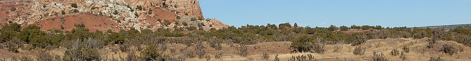
In a land where water is the critical variable, the drainage in the Galisteo “Basin” is very complex. Galisteo Creek joins the Rio Grande near Cochiti Pueblo. It is fed by numerous arroyos which must circumvent volcanic dikes, low mountains, and mesas in their downward course. All of the large pueblos are located on major water courses. Today most of those water courses are dry much of the time. Some of that dryness results from modern impoundment and groundwater use, but it is notable that the largest, longest-occupied pueblos—San Marcos, San Lazaro, Galisteo, and San Cristóbal—are on drainages that are the most likely to contain water now. A number of the drainages follow rather tortuous courses; other important ones are on either side of small drainage divides.
The Rio Santa Fe is a larger stream than Galisteo Creek, drawing more water from the higher peaks east of the city. On the east the drainage divide between the Rio Santa Fe and Galisteo Creek is not a dramatic mountainous feature, rather the high ground around Arroyo Hondo—the Bobcat Summit. Arroyo Hondo with Bonanza Creek drain to the Rio Grande, while the Pueblo and Gallina Arroyos and the  Eldorado area drain to the Galisteo. At the west the divide is more marked, consisting of los Cerrillos. This rather subtle divide between two important water features on the pueblo landscape is visible in the similarity of contemporary pueblos in the two drainages: while there was surely linguistic diversity within the larger area especially as population density increased, there is no reason to think that the separation of the drainage basins—of which the people were indubitably aware—formed any kind of cultural boundary.
Some interesting examples of the drainage complexity are Pueblo Largo which is located on a ridge. To the east is the Cañada Estacada which flows north to the Galisteo; on the west is Arroyo de la Jara which flows south and west past Pueblos Colorado and She, reaching the Galisteo well down stream from the Estacada. Arroyo del Chorro runs north through Pueblo San Lazaro, Arroyos San Lazaro and de le Joya join del Chorro which runs into the Galisteo. Cañada del Medio bisects Pueblo Blanco; its head is on Cerro Pelón a short distance from Arroyo San Lazaro. Again, Pueblo Blanco is separated from the la Joya Flats and the many field houses there, by a drainage divide, but no great physical barrier.

Featured Site
Pueblo San Marcos
Pueblo San Marcos was one of the largest prehistoric adobe settlements in North America...
More about Pueblo San Marcos »© New Mexico Office of Archaeological Studies, a division of the New Mexico Department of Cultural Affairs.
The Center for New Mexico Archaeology
7 Old Cochiti Road
Santa Fe, NM 87507
505-476-4404
Fax: 505-476-4448