
Text of the Galisteo Basin Archaeological Sites Protection Act
H. R. 506
One Hundred Eighth Congress
of the United States of America
AT THE SECOND SESSION
Begun and held at the City of Washington on Tuesday,
the twentieth day of January, two thousand and four
An Act
To provide for the protection of archaeological sites in the Galisteo Basin in New Mexico, and for other purposes.
Be it enacted by the Senate and House of Representatives of the United States of America in Congress assembled,
SECTION 1. SHORT TITLE.
This Act may be cited as the ‘‘Galisteo Basin Archaeological Sites Protection Act’’.
SEC. 2. FINDINGS AND PURPOSE.
(a) FINDINGS.—The Congress finds that—
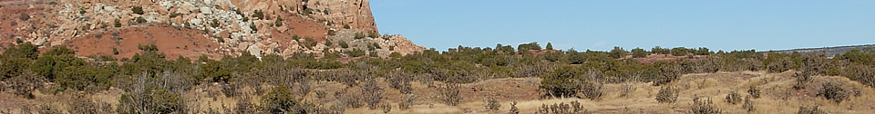
- the Galisteo Basin and surrounding area of New Mexico is the location of many well preserved prehistoric and historic archaeological resources of Native American and Spanish colonial cultures;
- these resources include the largest ruins of Pueblo Indian settlements in the United States, spectacular examples of Native American rock art, and ruins of Spanish colonial settlements; and
- these resources are being threatened by natural causes, urban development, vandalism, and uncontrolled excavations.
(b) PURPOSE.—The purpose of this Act is to provide for the preservation, protection, and interpretation of the nationally significant archaeological resources in the Galisteo Basin in New Mexico.
SEC. 3. GALISTEO BASIN ARCHAEOLOGICAL PROTECTION SITES.
(a) IN GENERAL.—Except as provided in subsection (d), the following archaeological sites located in the Galisteo Basin in the State of New Mexico, totaling approximately 4,591 acres, are hereby designated as Galisteo Basin Archaeological Protection Sites:
Name Acres
Arroyo Hondo Pueblo ....................................................................... 21
Burnt Corn Pueblo ........................................................................... 110
Chamisa Locita Pueblo .................................................................... 16
Comanche Gap Petroglyphs ............................................................. 764
Espinoso Ridge Site .......................................................................... 160
La Cienega Pueblo & Petroglyphs .................................................. 126
La Cienega Pithouse Village ........................................................... 179
La Cieneguilla Petroglyphs/Camino Real Site ............................... 531
La Cieneguilla Pueblo ...................................................................... 11
Lamy Pueblo ..................................................................................... 30
Lamy Junction Site .......................................................................... 80
Las Huertas ...................................................................................... 44
Pa’ako Pueblo .................................................................................... 29
Petroglyph Hill ................................................................................. 130
Pueblo Blanco ................................................................................... 878
Pueblo Colorado ................................................................................ 120
Pueblo Galisteo/Las Madres ............................................................ 133
H. R. 506—2
Name Acres
Pueblo Largo ..................................................................................... 60
Pueblo She ........................................................................................ 120
Rote Chert Quarry ........................................................................... 5
San Cristobal Pueblo ........................................................................ 520
San Lazaro Pueblo ........................................................................... 360
San Marcos Pueblo ........................................................................... 152
Upper Arroyo Hondo Pueblo ............................................................ 12
Total Acreage ......................................................................... 4,591
(b) AVAILABILITY OF MAPS.—The archaeological protection sites listed in subsection (a) are generally depicted on a series of 19 maps entitled ‘‘Galisteo Basin Archaeological Protection Sites’’ and dated July, 2002. The Secretary of the Interior (hereinafter referred to as the ‘‘Secretary’’) shall keep the maps on file and available for public inspection in appropriate offices in New Mexico of the Bureau of Land Management and the National Park Service.
(c) BOUNDARY ADJUSTMENTS.—The Secretary may make minor boundary adjustments to the archaeological protection sites by publishing notice thereof in the Federal Register.
(d) WITHDRAWAL OF PRIVATE PROPERTY.—Upon the written request of an owner of private property included within the boundary of an archaeological site protected under this Act, the Secretary shall immediately remove that private property from within that boundary.
SEC. 4. ADDITIONAL SITES.
(a) IN GENERAL.—The Secretary shall—
- continue to search for additional Native American and Spanish colonial sites in the Galisteo Basin area of New Mexico;
and - submit to Congress, within 3 years after the date funds become available and thereafter as needed, recommendations for additions to, deletions from, and modifications of the boundaries of the list of archaeological protection sites in section 3 of this Act.
(b) ADDITIONS ONLY BY STATUTE.—Additions to or deletions from the list in section 3 shall be made only by an Act of Congress.
SEC. 5. ADMINISTRATION.
(a) IN GENERAL.—
- The Secretary shall administer archaeological protection sites located on Federal land in accordance with the provisions of this Act, the Archaeological Resources Protection Act of 1979 (16 U.S.C. 470aa et seq.), the Native American Graves Protection and Repatriation Act (25 U.S.C. 3001 et seq.), and other applicable laws in a manner that will protect, preserve, and maintain the archaeological resources and provide for research thereon.
- The Secretary shall have no authority to administer archaeological protection sites which are on non-Federal lands except to the extent provided for in a cooperative agreement entered into between the Secretary and the landowner.
- Nothing in this Act shall be construed to extend the authorities of the Archaeological Resources Protection Act of 1979 or the Native American Graves Protection and Repatriation Act to private lands which are designated as an archaeological protection site.
(b) MANAGEMENT PLAN.—
H. R. 506—3
(1) IN GENERAL.—Within 3 complete fiscal years after the date funds are made available, the Secretary shall prepare and transmit to the Committee on Energy and Natural Resources of the United States Senate and the Committee on Resources of the United States House of Representatives, a general management plan for the identification, research, protection, and public interpretation of—
(A) the archaeological protection sites located on Federal land; and
(B) for sites on State or private lands for which the Secretary has entered into cooperative agreements pursuant
to section 6 of this Act.
(2) CONSULTATION.—The general management plan shall be developed by the Secretary in consultation with the Governor
of New Mexico, the New Mexico State Land Commissioner, affected Native American pueblos, and other interested parties.
SEC. 6. COOPERATIVE AGREEMENTS.
The Secretary is authorized to enter into cooperative agreements with owners of non-Federal lands with regard to an archaeological protection site, or portion thereof, located on their property. The purpose of such an agreement shall be to enable the Secretary to assist with the protection, preservation, maintenance, and administration of the archaeological resources and associated lands.
Where appropriate, a cooperative agreement may also provide for public interpretation of the site.
SEC. 7. ACQUISITIONS.
(a) IN GENERAL.—The Secretary is authorized to acquire lands and interests therein within the boundaries of the archaeological protection sites, including access thereto, by donation, by purchase with donated or appropriated funds, or by exchange.
(b) CONSENT OF OWNER REQUIRED.—The Secretary may only acquire lands or interests therein with the consent of the owner thereof.
(c) STATE LANDS.—The Secretary may acquire lands or interests therein owned by the State of New Mexico or a political subdivision thereof only by donation or exchange, except that State trust lands may only be acquired by exchange.
SEC. 8. WITHDRAWAL.
Subject to valid existing rights, all Federal lands within the archaeological protection sites are hereby withdrawn—
- from all forms of entry, appropriation, or disposal under the public land laws and all amendments thereto;
- from location, entry, and patent under the mining law and all amendments thereto; and
- from disposition under all laws relating to mineral and geothermal leasing, and all amendments thereto.
SEC. 9. SAVINGS PROVISIONS.
Nothing in this Act shall be construed—
- to authorize the regulation of privately owned lands within an area designated as an archaeological protection site;
- to modify, enlarge, or diminish any authority of Federal, State, or local governments to regulate any use of privately owned lands;
H. R. 506—4 - to modify, enlarge, or diminish any authority of Federal, State, tribal, or local governments to manage or regulate any use of land as provided for by law or regulation; or
- to restrict or limit a tribe from protecting cultural or religious sites on tribal lands.
Speaker of the House of Representatives.
Vice President of the United States and President of the Senate.

Featured Site
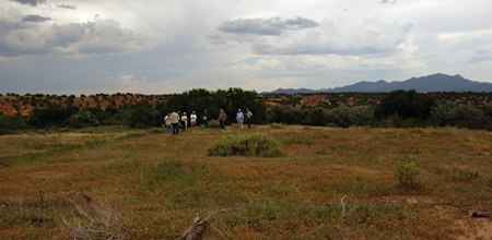
Pueblo San Marcos
Pueblo San Marcos was one of the largest prehistoric adobe settlements in North America...
More about Pueblo San Marcos »© New Mexico Office of Archaeological Studies, a division of the New Mexico Department of Cultural Affairs.
The Center for New Mexico Archaeology
7 Old Cochiti Road
Santa Fe, NM 87507
505-476-4404
Fax: 505-476-4448