
Espinoso Ridge Pueblo
Galisteo Basin Sites
- Lamy Jct
- Lower Arroyo Hondo Pueblo
- El Camino Real
- Chamisa Locita
- El Crestón
- Espinoso Ridge Pueblo
- La Cienega Pueblo (LA 3)
- La Cienega Pithouse Village
- La Cieneguilla Pueblo (LA 16)
- La Cieneguilla Petroglyphs
- Manzanares Pueblo
- Paa-ko
- Petroglyph Hill
- Pueblo Blanco
- Pueblo Colorado
- Pueblo Galisteo
- Pueblo Largo
- Pueblo San Cristóbal
- Pueblo San Lazaro
- Pueblo Shé
- Rote Chert Quarry
- San José de Las Huertas
- Upper Arroyo Hondo Pueblo
- Pueblo San Marcos
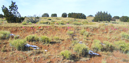
Espinoso Ridge Pueblo (LA 278) includes two structural components, one prehistoric and the other, historic.
The prehistoric component is a massive adobe mound, the
remains of a pueblo with 350 or so rooms. The core of the prehistoric ruin is a
rectangular structure 60 m by 40 m (200 by 130 ft) in size built around a large
plaza, with an opening on its eastern side. Additional roomblocks appended to
the structure include one on the southeast, one on the northeast, and two long
parallel roomblocks further north. A separate adobe structure may be
represented by a 10 m  (30 ft) diameter mound located about 100 m (300 ft) east
of the main pueblo. Although there is no direct evidence of a kiva, the
presence of such a feature may be indicated by a large pot hunters' hole in the
plaza. Dense middens with ashy soil and tens of thousands of sherds and lithic
artifacts occur on all four sides of the pueblo, as well as within the plaza.
Other prehistoric features within the site boundaries include a two room
fieldhouse, a small cairn, a semi-circular scatter of cobbles, a rectangular
cobble/boulder alignment, a boulder with possible cupules, and a natural
spring. Ceramic cross dating suggests that the principal occupation occurred
between AD 1325 and 1500. Mera designated this site as the type site for Largo
Glaze B pottery.
(30 ft) diameter mound located about 100 m (300 ft) east
of the main pueblo. Although there is no direct evidence of a kiva, the
presence of such a feature may be indicated by a large pot hunters' hole in the
plaza. Dense middens with ashy soil and tens of thousands of sherds and lithic
artifacts occur on all four sides of the pueblo, as well as within the plaza.
Other prehistoric features within the site boundaries include a two room
fieldhouse, a small cairn, a semi-circular scatter of cobbles, a rectangular
cobble/boulder alignment, a boulder with possible cupules, and a natural
spring. Ceramic cross dating suggests that the principal occupation occurred
between AD 1325 and 1500. Mera designated this site as the type site for Largo
Glaze B pottery.
The historic component consists primarily of the remains of a homestead and associated features, including an adobe house, a substantial chicken coop, a corral, remnants of several tanks, reservoirs, and troughs associated with use of the spring, traces of a fence that once enclosed an orchard, and a possible outhouse location. Documentary and oral history information indicate that this location was used from sometime prior to 1919 until 1942 or later.
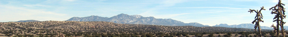
LA 278 is near the confluence of Arroyo de la Vega de los Tanos and a major unnamed eastern tributary. Upstream from the site Arroyo de la Vega de los Tanos has a watershed of approximately 1620 hectares (4000 acres), while the tributary has a watershed of 485 hectares (1200 acres). There is a 50 m (165 ft) wide floodplain along the main arroyo. The arroyo itself has a braided channel, incised a meter or so (ca. 3 ft) into the floodplain. The Arroyo de la Vega de los Tanos drains directly to the Rio Grande, joining the river between San Felipe and Kewa Pueblos. There is a small, unnamed spring immediately south of the ruin (see site map). This spring is actually about 30 m (100 ft) south of the position indicated on the USGS topographic map. The spring never goes dry, even during periods of prolonged drought, such as the 1950s. While the homestead was occupied water from the spring was sufficient to support a small apple orchard, as well as providing domestic water for people and livestock.

Featured Site
Lamy Junction Community
The Lamy Junction Community is a group of 14 small Coalition-era structures and pueblos...
More about Lamy Junction Community »© New Mexico Office of Archaeological Studies, a division of the New Mexico Department of Cultural Affairs.
The Center for New Mexico Archaeology
7 Old Cochiti Road
Santa Fe, NM 87507
505-476-4404
Fax: 505-476-4448