
Pueblo San Lazaro
Galisteo Basin Sites
- Lamy Jct
- Lower Arroyo Hondo Pueblo
- El Camino Real
- Chamisa Locita
- El Crestón
- Espinoso Ridge Pueblo
- La Cienega Pueblo (LA 3)
- La Cienega Pithouse Village
- La Cieneguilla Pueblo (LA 16)
- La Cieneguilla Petroglyphs
- Manzanares Pueblo
- Paa-ko
- Petroglyph Hill
- Pueblo Blanco
- Pueblo Colorado
- Pueblo Galisteo
- Pueblo Largo
- Pueblo San Cristóbal
- Pueblo San Lazaro
- Pueblo Shé
- Rote Chert Quarry
- San José de Las Huertas
- Upper Arroyo Hondo Pueblo
- Pueblo San Marcos
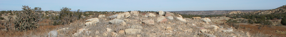
The site consists of a series of seventeen roomblocks and five midden areas as numbered by Nels Nelson in the map in his 1914 publication.
Nelson did not assign numbers to an additional eight Puebloan structures as well as a series of Puebloan landscape features including a reservoir, a vertical shaft opening into a tunnel, two water-collection features comprised of channels and depressions chipped into the sandstone bedrock, two small rock shelters, rock art and cupules, four possible kilns, at least peripheral five rock concentrations (of which four represent possible structures), and a hilltop shrine. Nelson excavated 60 rooms and estimated the number of ground-floor rooms at 1,941, the largest pueblo he worked at. Other estimates place the number of rooms at 5,000. The artifacts from Nelson’s excavations are in the American Museum of Natural History.

Adjacent to the easternmost historic pueblo roomblock (XVI) are the remains of a church and associated convento. This church served first as a mission and later was reduced to a visita of Galisteo. Historic non-Pueblo structures and features are represented by a square ruin that Nelson referred to as a lime kiln but which was more likely a corral or other historic feature, a small stone building north of the Puebloan roomblocks, a second historic building and pit at the north end of the site just over the fence defining BLM land and the foundations of a third to the south, and several low walls in the roomblocks themselves and on rocky outcrops in the surrounding area that likely contained livestock in historic times.

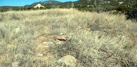
Open masonry room in Roomblock II, probably excavated by Nelson.
Artifacts present at the site are consistent with what would be expected at a very large communal pueblo with a Spanish occupation component. Based on ceramic types, it appears that the area was first occupied from the early 1300s to the early 1500s, with a reoccupation from approximately 1600 until the Pueblo Revolt in 1680. San Lázaro is an exceptional site with extraordinary information potential.
The site measures 1,230 m north-south by 1,430 m east-west, an area of 176 ha. The roomblocks and other features are clustered towards the center except for some of the historic stone walls.
The site is Number 113 on the State Register of Historic Places, and was placed on the National Register of Historic Places in 1996. The eastern, historic portion of the pueblo is owned by the BLM, the remainder is in private hands.

Featured Site
Upper Arroyo Hondo Pueblo
Upper Arroyo Hondo Pueblo (LA 76) is a small to medium-sized pueblo of multistoried masonry/adobe roomblocks...
More about Upper Arroyo Hondo Pueblo »© New Mexico Office of Archaeological Studies, a division of the New Mexico Department of Cultural Affairs.
The Center for New Mexico Archaeology
7 Old Cochiti Road
Santa Fe, NM 87507
505-476-4404
Fax: 505-476-4448