
Upper Arroyo Hondo Pueblo
Galisteo Basin Sites
- Lamy Jct
- Lower Arroyo Hondo Pueblo
- El Camino Real
- Chamisa Locita
- El Crestón
- Espinoso Ridge Pueblo
- La Cienega Pueblo (LA 3)
- La Cienega Pithouse Village
- La Cieneguilla Pueblo (LA 16)
- La Cieneguilla Petroglyphs
- Manzanares Pueblo
- Paa-ko
- Petroglyph Hill
- Pueblo Blanco
- Pueblo Colorado
- Pueblo Galisteo
- Pueblo Largo
- Pueblo San Cristóbal
- Pueblo San Lazaro
- Pueblo Shé
- Rote Chert Quarry
- San José de Las Huertas
- Upper Arroyo Hondo Pueblo
- Pueblo San Marcos
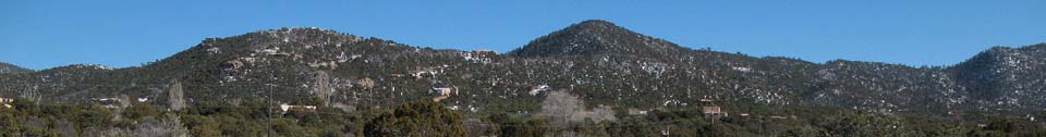
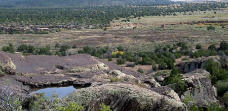
Upper Arroyo Hondo Pueblo (LA 76) is a small to medium-sized pueblo of multistoried masonry/adobe roomblocks in a U-shaped configuration surrounding a plaza containing at least one kiva.
Dating possibly to the late Coalition and perhaps Classic periods, the site has often been considered a predecessor to the larger Lower Arroyo Hondo Pueblo, LA 12. The site is on top of a rise in the alluvial plain, surrounded almost completely by two branches of Arroyo Hondo, the main channel and a side drainage, forming a virtual island. Vegetation is piñon-juniper woodland. The open area of the pueblo itself is covered with a mix of grasses, short shrubs, and invasive weeds. The site is enclosed by the foothills of the Sangre de Cristos in a narrow part of Arroyo Hondo canyon near the headwaters of the drainage. There is a small amount of level land available near the village that would have been suitable for agriculture. The site is surrounded by low-density residential and commercial development and is bounded on the west-southwest by Old Las Vegas Highway (US 84/285).
")
The first Euroamerican notation on LA 76 may be the mention of its existence in Adolf Bandelier’s diary of 1882. Local contacts told him of two pueblos in Arroyo Hondo, south of Santa Fe (LA 12 and LA 76). Based on his entry of November 21, 1882, he visited and made a sketch map (see attached photocopy; Lange et al. 1966:359–360). Nels Nelson visited the site in 1915, made a sketch map, and excavated 12 rooms (see attached photocopy, on file at ARMS). His notes indicate that black-on-white, gray utility, and “red ware” pottery was recovered, along with lithic debitage, ground stone, some effigy vessels, a bone awl, a bone whistle, and faunal remains. An excavation was carried out in 1934 by Stanley Stubbs of the Laboratory of Anthropology with a crew from the Civil Works Administration

Featured Site
Pueblo San Cristóbal
The impressive Pueblo San Cristóbal (LA 80) was the first and most extensively excavated of the sites studied by Nels C. Nelson...
More about Pueblo San Cristóbal »© New Mexico Office of Archaeological Studies, a division of the New Mexico Department of Cultural Affairs.
The Center for New Mexico Archaeology
7 Old Cochiti Road
Santa Fe, NM 87507
505-476-4404
Fax: 505-476-4448